MPA Europe uses a holistic range of measures that include the range of biodiversity from species to ecosystems, including habitats, areas will be prioritised using systematic conservation planning software. This enables alternative weighting of variables and multiple scenarios and thus support wider marine spatial planning.
The project adopts an interdisciplinary approach, employing comprehensive measures of biodiversity that encompass variation both within and between species and ecosystems. It also considers various environmental variables, carbon cycle dynamics, and climate change scenarios. Our team consists of experts in marine biology, taxonomy, ecology, oceanography, biogeochemistry, biogeography, MPA network design, benthic habitat mapping, carbon dynamics, as well as species distribution and climate modeling.
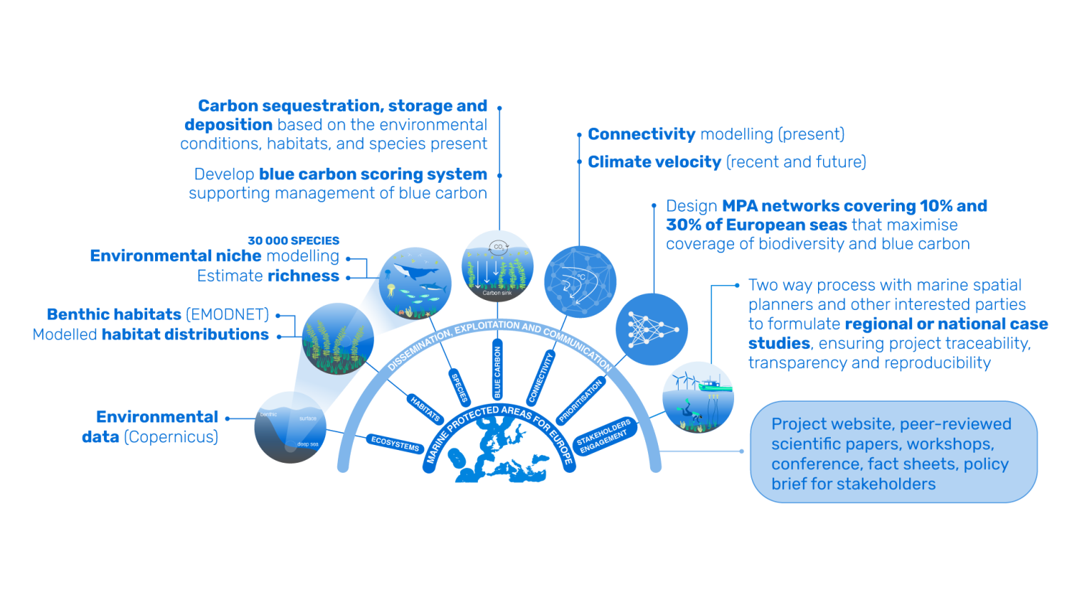
The project is ambitious in committing to achieve several firsts in terms of products based on new data and analyses: (1) Maps of an optimal MPA network in European seas prioritised for biodiversity protection and blue carbon benefits; (2) Maps of species richness in European seas based on multiple indicators, including actual observed data, statistical estimators, and modelled geographic range maps; (3) Potential geographic distributions of important biogenic habitats in European seas.
MPA Europe project has been approved under HORIZON-CL6-2021-BIODIV-01-12 — Improved science based maritime spatial planning and identification of marine protected areas.